
En route to these islands that "brush the clouds," between Montserrat and Nevis, lies Redonda Rock, about a mile long and 1000' high. In the late 1800's about 100 people actually lived on this rock, which was mined for phosphate.

Redonda Rock

evidence of its' past, when it was mined for phosphate
En route between Redonda and Nevis, Gil caught dinner!

"Dine and Dash." The culprit escaped.
Well, we thought he had. Fortunately, the next one was boarded whole - a tuna.

2 dinners, but only one for us

St. Kitts & Nevis' flag above HYC's burgee
Most of our stay on St. Kitts was spent in Majors Bay, on its’ south shore; as it afforded the best protection and greatest comfort from the large north swell and strong northeasterly winds which we had for several days.

Serenada anchored in Majors Bay, St. Kitts (Nevis in the background)
It’s very picturesque, as Nevis’ peak was viewed from our cockpit, and an
unspoiled white sand beach lined the shore.


This was a relatively quiet time
for us, as this anchorage is remote from most anything on the island, except
that it is the terminus for the Sea Bridge ferry to Nevis.

Sea Bridge ferry between St. Kitts and Nevis
We had some beach time. We also hiked, but as there were no trails, we trailblazed our own; at times a thorny experience!

Sea Bridge ferry between St. Kitts and Nevis
We had some beach time. We also hiked, but as there were no trails, we trailblazed our own; at times a thorny experience!

trailblazing through the tall grasses, while avoiding those thorny green bushes

our reward - the views!


back down to the boat

one of several ruined windmills used on the sugar plantations
Once the winds went more east / less north, and settled
some, we moved over to Friar’s Bay on St. Kitts’ west coast.

The 'Strip' on Friar's Bay
From here, it was
much more convenient to explore the island. Some time was spent in Basseterre,
the capital. There seemed always to be 2-3 cruise ships in port, which made for
bustling streets.

The Circus


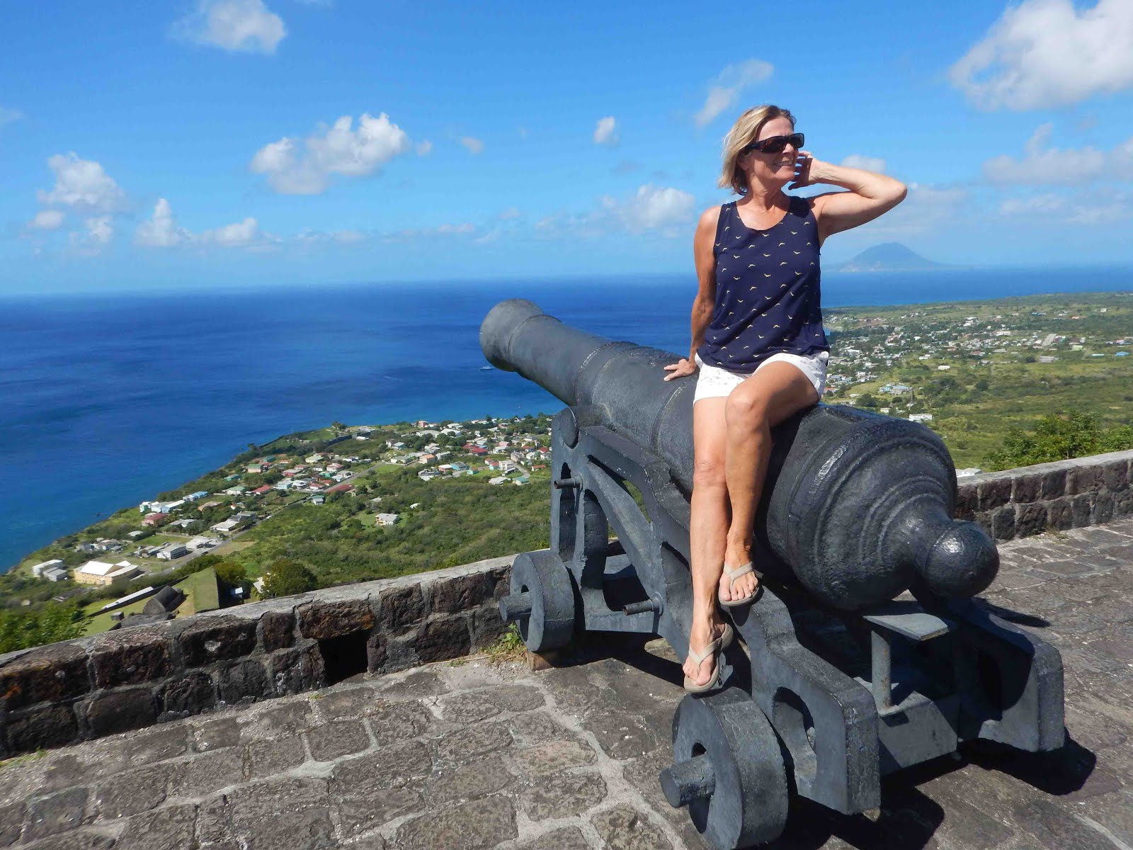
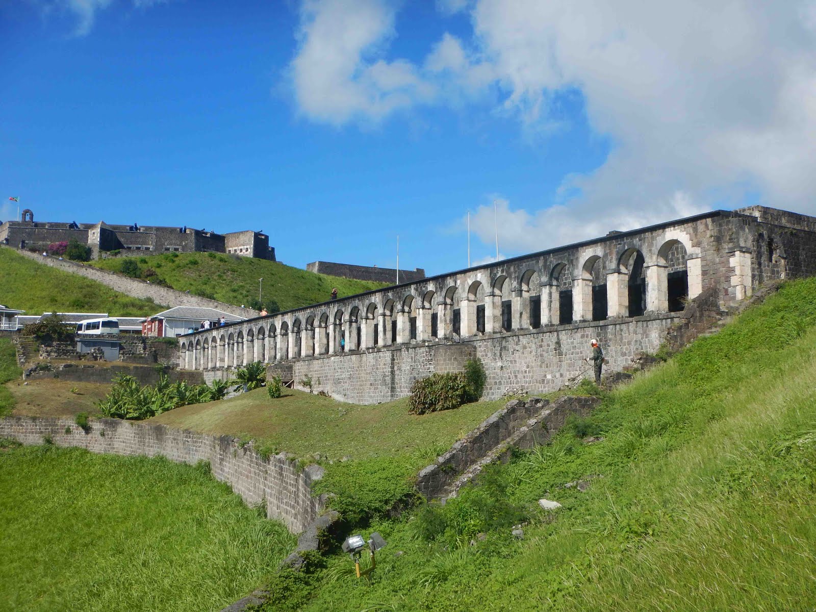
St. Kitts is home to Brimstone Hill, a world UNESCO heritage
site, of the largest fortress in the West Indies. We spent much time here, as
it was impressive. I’ll let the pictures (probably too many of them!) do the talking….

water catchment and cistern


the lime kiln

my fearless Captain Gil on the rim of the lime kiln
St. Kitts (and Nevis) are also home to thousands of African
Vervet monkeys, descendants of a few originally brought over as pets by sugar
cane planters. One of my disappointments was not seeing any in the wild. I did
see some, but they were wearing jackets! (for the tourists) A local woman we spoke with
described the monkeys as a huge nuisance, as they raid people’s gardens. She
explained that many people have dogs to deter them, but sometimes the monkeys
and dogs befriend each other!
The day came when we said good-bye to St. Kitts to sail further north to St. Eustatius (Statia).
The day came when we said good-bye to St. Kitts to sail further north to St. Eustatius (Statia).

a passing barge, en route to St. Eustatius

St. Eustatius' flag above HYC's burgee on Serenada
St. Eustatius (Statia) lies just north of St. Kitts. It has a population of under 4,000. It’s
a small island with a large history. In the mid to late 1700’s, Statia was the
West Indies’ trade capital and one of the world’s busiest ports. The Dutch, who
owned Statia then as now, opened Statia as a free port to all countries.
European nations, many at war with each other, and not allowed to trade
directly, could trade and deal
through Statia.

cobblestone streets in Statia
Times have changed, but Statia remains unique. As we approached, we saw numerous oil tankers, container ships, barges and tug boats anchored off its shore. This small island has a huge fuel loading dock, and huge oil storage facility.

fuel loading dock below oil storage facility in Statia

Statia only has one anchorage, in Oranje Bay, site of its’
past and present port and capital. Many ruins can be seen along the shore, below
the cliff edge, where at one time there was a sea wall which protected a long
street of shops and warehouses.

ruins of a once bustling port

two story buildings are now buried


restored warehouse, now a bar
Up on the cliff top sat Fort Oranje, now beautifully restored by the Dutch government.

Fort Oranje


Serenada as seen from Fort Oranje

This way to the Quill

ruins of a once bustling port

two story buildings are now buried


restored warehouse, now a bar
Up on the cliff top sat Fort Oranje, now beautifully restored by the Dutch government.

Fort Oranje


Serenada as seen from Fort Oranje

This way to the Quill
Statia’s peak, which we hiked to, is at the rim of the Quill (Dutch: kuil = pit), a dormant volcano.

Whoa! Which way?

.... this way .... getting there

at the crater's rim

... where we met a friendly rooster
A side trail took us from the crater's rim up to a panorama lookout, which afforded us incredible views of the island.

Saba can be seen on the horizon, from the peak of the Quill volcano on Statia

A difficult side trail took us down into the crater. Many rope lines aided the descent (and ascent) over boulders and rocks.


Inside the crater was a lush evergreen seasonal forest, closely related to a tropical rain forest, with the tallest trees reaching 40 meters. Trees found inside the crater included the prickly silk cotton, and the large leafed trumpet trees.

silk cotton tree

humongous!!

cheerleading with trumpet tree leaves

strangler fig
Upon returning to Serenada, we smiled at the sight of some of the islands' goats...


After time on Statia, and with the weather remaining very settled, we continued on to Saba.

a becalmed Caribbean sea, the perfect time to visit Saba

Saba's flag above HYC's burgee on Serenada
Saba is essentially an enormous rock.. A mere 5 square miles, it reaches a
lofty 3084 feet. It has a population of only 1500. Until the early 1940’s Saba was almost inaccessible. Everything
had to come and go via Ladder Bay.

The old Customs House at Ladder Bay, Saba

This extraordinary landing provides scant shelter from ocean swells. Some 800 steps are cut into the rock. The steepness and elevation can be appreciated from the sea by looking up at the old customs house, which is only half way up! Boats could only land when the sea was calm.

Fort Bay, Saba's port landing today

Saba's runway - the world's shortest!
Saba boasts the shortest airport runway in the world! It’s akin to landing on an aircraft
carrier. Flights are weather dependent, as crosswinds can negate take-offs or
landings. We spoke with one person, who related the story of a friend’s stay
which was extended by 3 days while waiting for a flight out.
From the sea, Saba looks like a rock, but up high in the
hills, it is lush and scenic. Saban cottages are all whitewashed, green trimmed
and red roofed; and the streets are spotlessly clean.


Sabans must be very pragmatic people, judging from the names
of places. The two towns are named Bottom (guess where?) and Windward (guess
where again?). Mount Scenic is its’ peak, and Ladder Bay rather explains itself
also.

Mt. Scenic, as seen from Windward

Mt. Scenic, as seen from Windward
It’ll be no surprise to learn that Gil & I hiked up to
the peak – we seem always to be drawn to them. The trail had over 1,000 steps,
but it was very well maintained. The tropical rain forest was the lushest of
any we’ve seen in the islands, and the views were spectacular; a great reward
for our effort. Again, I'll let the pictures do the talking....


dwarfed by the lush vegetation!


finally, the peak!


Windward from Mt. Scenic's peak


1,084 steps to the peak


it's over! .... done like dinner
Some cute shots from Saba...

gate to a daycare center
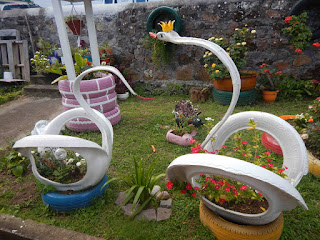
recycled tires made beautiful

Saba proud
I'll leave this blog post with Saba sunset photos...

Statia, St. Kitts, Nevis, and even Montserrat!

Lining the life guys. Miss you, and miss being out there.
ReplyDeleteLooks great, off to Roatan this Sunday---will enjoy the sun and the water allow it is mild right now we have had a lot of snow and our share of cold weather. Take care
ReplyDeleteGeorgie